The core
Sukhothai
The capital
See the cycling dayGuides
Language
Currency
Check datesfrom $49 · no cancel feeLocate your stop
Map of 33 stops
Choose a route, then tap a pin or stop for its note and a Google Maps link.
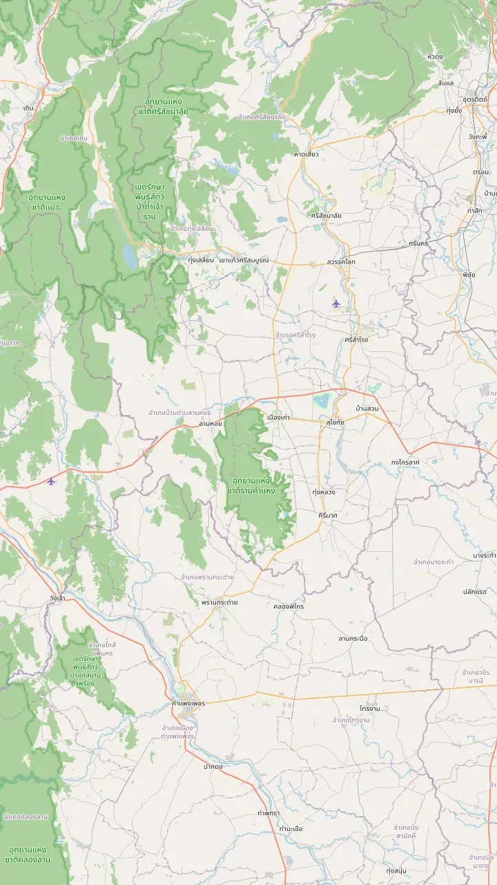
The park lies 12 km from the town of Sukhothai on the Sukhothai-Tak highway.
Google MapsUNESCO calls Si Satchanalai the spiritual centre of the kingdom and a centre of its ceramic exports.
Google MapsUNESCO describes Kamphaeng Phet as the kingdom's southern frontier town with military functions.
Google Maps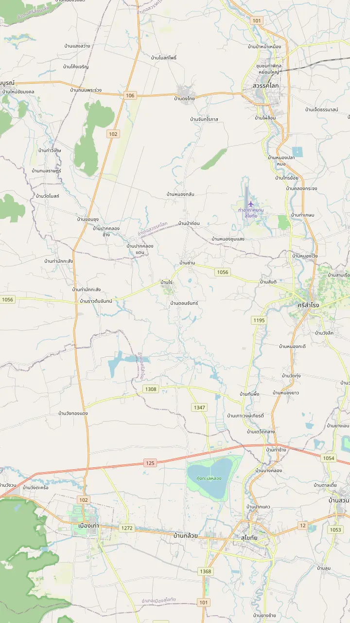
The modern town, with the shops and the bus terminal, where the Saturday walking street market sets up in the evening.
Google MapsThe park lies 12 km from the town of Sukhothai on the Sukhothai-Tak highway.
Google MapsThe airport nearest to the park; UNESCO describes it as dedicated almost exclusively to bringing visitors to the historic towns.
Google MapsA town north of the airport whose old Chinese quarter has street art made in a 2019 TAT project.
Google Maps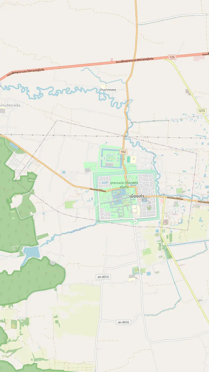
TAT calls Wat Mahathat the centre of the historical park, with a grand pagoda ringed by 8 smaller ones as if they were a lotus.
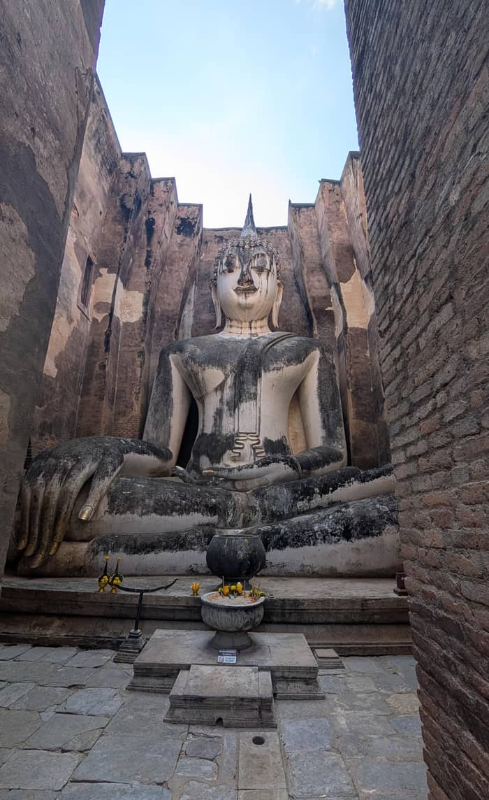
Google MapsHome of Phra Atchana, a gigantic seated Buddha image in the main hall.
Google MapsThe Fine Arts Department names its prasart among the Khmer-influenced works at ancient Sukhothai.
Google MapsThe temple stands in the Aranyik area, where King Ramkhamheng joined the Kathina ceremony at the end of Buddhist Lent.
Google MapsA temple in the eastern part of the park, on the road toward the town.
Google MapsSouth of Wat Mahathat, with 3 Lopburi-style prangs behind a laterite wall.
Google MapsThe Ramkhamhaeng Museum stands near the park entrance and keeps finds from Sukhothai and Si Satchanalai.
Google Maps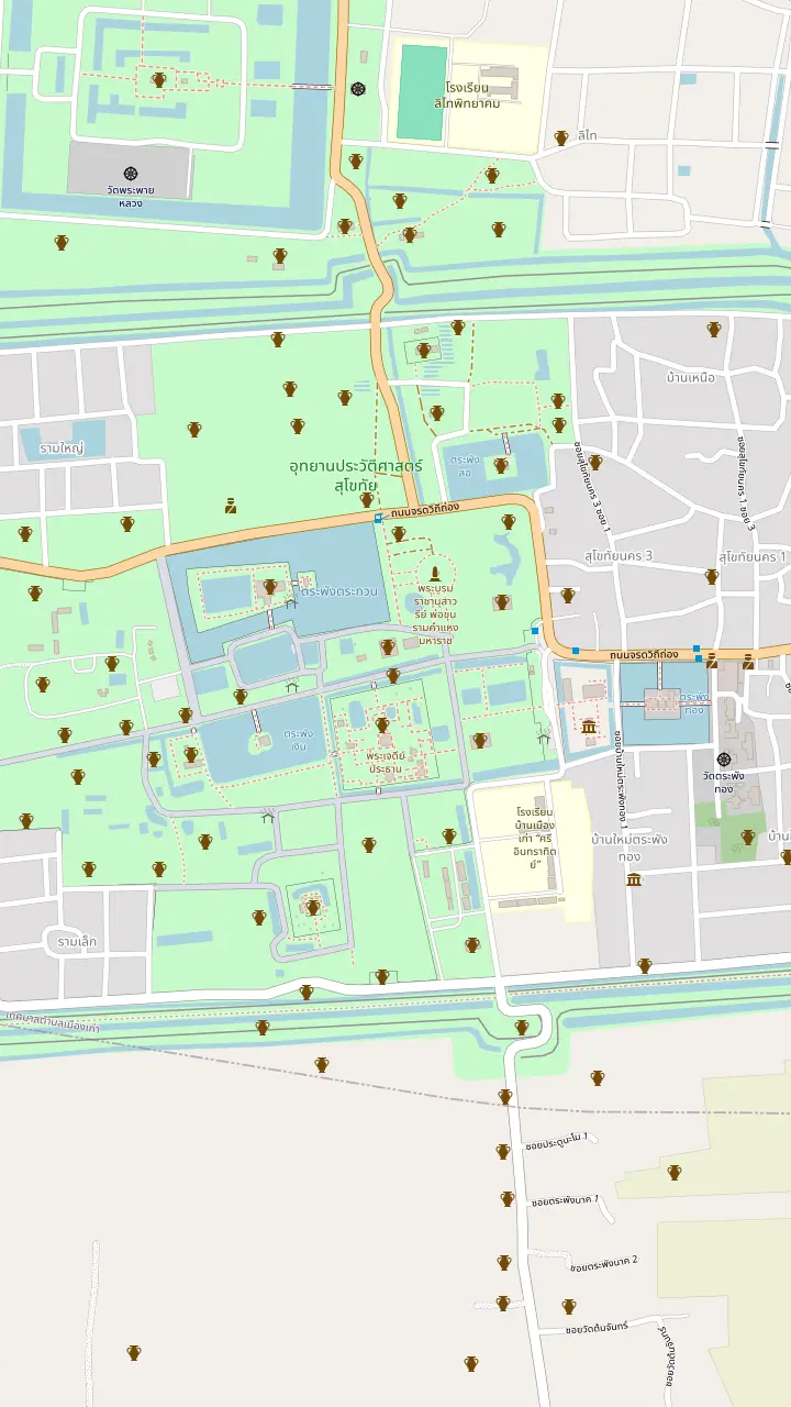
TAT calls Wat Mahathat the centre of the historical park, with a grand pagoda ringed by 8 smaller ones as if they were a lotus.
Google MapsNorth of Wat Mahathat. TAT says its main pagoda looks like a giant bell.
Google MapsNorth-west of Wat Mahathat, with its main sanctuary on an island in Traphang Trakuan Pond.
Google MapsWest of Wat Mahathat, with no surrounding wall and a single lotus-style pagoda.
Google MapsSouth of Wat Mahathat, with 3 Lopburi-style prangs behind a laterite wall.
Google MapsA bronze statue of King Ramkhamhaeng on the north side of Wat Mahathat, at the end of Jarod Vitee Tong road.
Google MapsA small shrine north of Wat Mahathat: a single laterite prang where Lop Buri-style sandstone Hindu objects were found.
Google MapsThe Ramkhamhaeng Museum stands near the park entrance and keeps finds from Sukhothai and Si Satchanalai.
Google Maps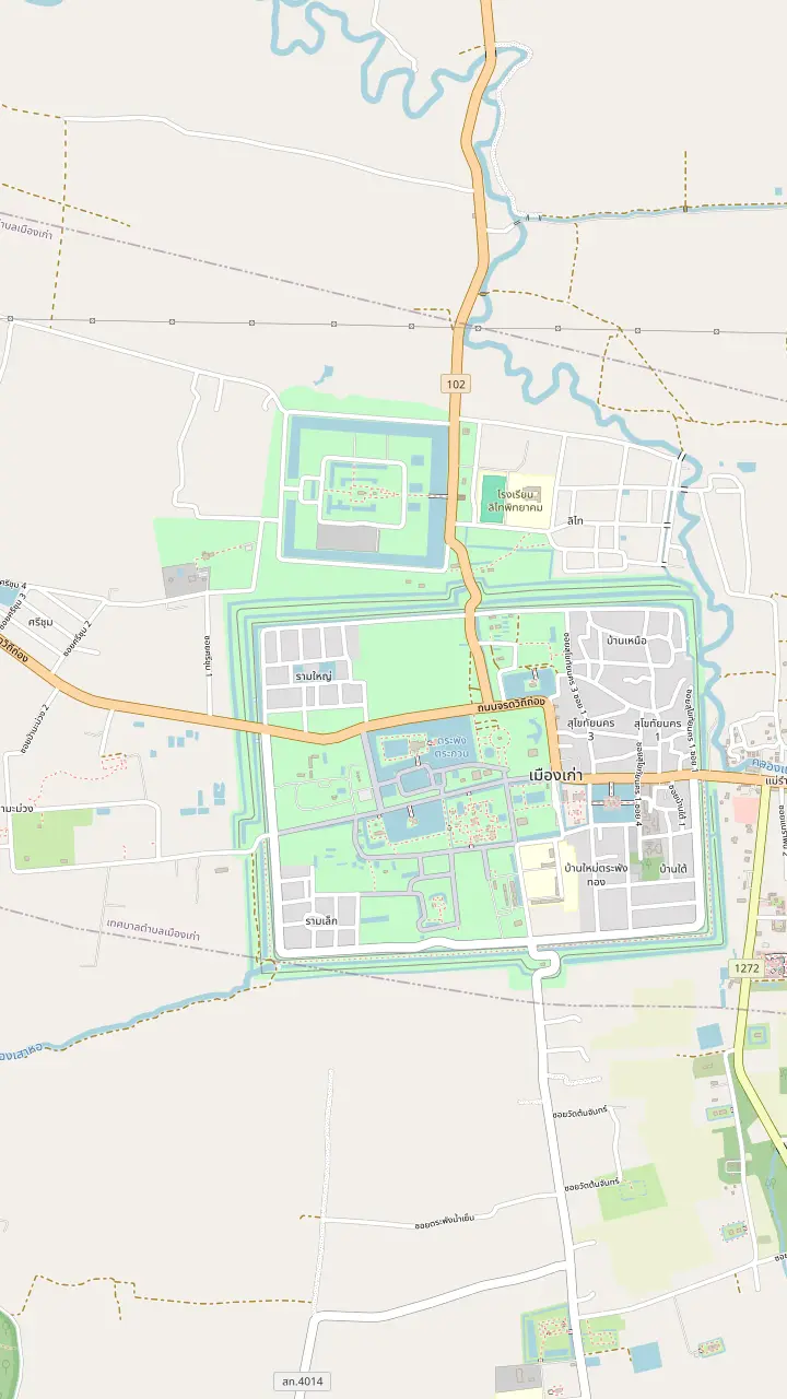
South of Wat Mahathat, with 3 Lopburi-style prangs behind a laterite wall.
Google MapsTAT calls Wat Mahathat the centre of the historical park, with a grand pagoda ringed by 8 smaller ones as if they were a lotus.
Google MapsHome of Phra Atchana, a gigantic seated Buddha image in the main hall.
Google MapsThe Fine Arts Department names its prasart among the Khmer-influenced works at ancient Sukhothai.
Google MapsThe Ramkhamhaeng Museum stands near the park entrance and keeps finds from Sukhothai and Si Satchanalai.
Google Maps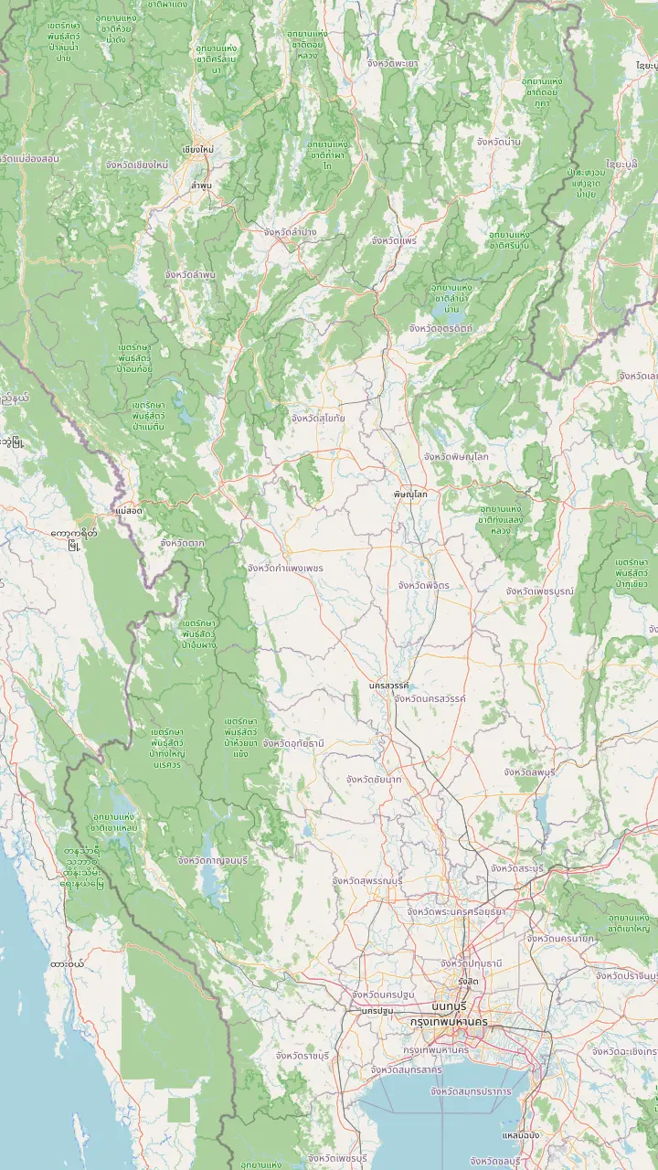
TAT puts Sukhothai 420 km north of Bangkok, four to five hours by car or 1 hour 15 minutes by air.
Google MapsThe kingdom in the south that Sukhothai ended up joining, according to the Fine Arts Department.
Google MapsAyuthaya made Pitsanulok the seat of a viceroy over the northern state.
Google MapsCentre of the Lan Na Kingdom, a rising power that put Sukhothai at risk.
Google MapsThe airport nearest to the park; UNESCO describes it as dedicated almost exclusively to bringing visitors to the historic towns.
Google MapsThe park lies 12 km from the town of Sukhothai on the Sukhothai-Tak highway.
Google Maps© OpenStreetMap contributors · map data
From a city state between two empires to the seat of the first Siamese kingdom, and from abandoned brick to a World Heritage Site: the story the park's ruins are standing in.
Editorial team, sukhothaihistoricalpark.click · Updated November 12, 2026 · A 7 min read
Basics
The history of Sukhothai begins in a crowded neighbourhood. The Fine Arts Department describes the area as lying between the great empires of the Pagan Kingdom in the west and the Khmer Kingdom in the east.1 A place on that frontier took ideas from both, and the department finds Khmer traces in the surrounding countryside.7
Religion shaped the look of the region before the Thai kings did. The department links a change of faith at the Khmer court to a change of images: Hindu worship figures gave way to Buddha images, and Buddhist legend entered the buildings.8 That is the world in which the first temples of the district were built, and it sets the scene for Wat Si Sawai, a Hindu-influenced site that later became a Buddhist temple.9
The ground itself also matters. The park is in Tambon Mueang Kao, Amphoe Mueang, Sukhothai Province,10 and the town of Sukhothai lies 12 km away on the Sukhothai-Tak highway.11 UNESCO says the first Kingdom of Siam grew out of that frontier ground, with Sukhothai as its capital.2 The rest of this page follows how that state rose, flourished and was absorbed, and how its ruins were rediscovered.
The associated towns
| Town | Role in the kingdom | Area |
|---|---|---|
| Sukhothai | Political and administrative capital2 | 7,000 ha20 |
| Si Satchanalai | Spiritual centre and ceramic exports21 | 4,514 ha20 |
| Kamphaeng Phet | Southern frontier with military functions22 | 338 ha20 |
Roles as UNESCO describes them; areas as listed for the serial property.23
The first written account of the kingdom comes from stone. The Fine Arts Department reads the 2nd stone inscription, found at Wat Si Chum, as the story of the early period of Sukhothai, and says it records that Phokhun Si Indrabodindratid became the primary monarch of the Sukhothai dynasty.12 That inscription gives Wat Si Chum a second claim on history.17
UNESCO frames the same event in a wider light. In its words, the first Kingdom of Siam had its capital at Sukhothai in the 13th and 14th centuries, and the town kept fine monuments that illustrate the beginnings of Thai architecture,2 and it adds that the three towns of the property shared a common language and alphabet and a common administrative and legal system.18 That is a description of a state, not just a city.
TAT also calls Sukhothai the very first capital city of Thailand,19 which makes the ruins the earliest chapter of a book whose later chapters were written in Ayutthaya and Bangkok. For a first-time visitor, that is a useful way to hold the park in mind: a beginning, not a museum of an ending. How old is Sukhothai Historical Park? The kingdom's golden age belongs to the 13th century, as TAT dates it.13 Seen that way, each temple is a page you can read in any order, and the museum is the index that explains the vocabulary.
The property in numbers
Areas of the 3 component towns as UNESCO lists them; the total is 11,852 hectares.20
King Ramkhamhaeng dominates the early story. TAT dates his reign, the golden age of Sukhothai, to the 13th century,13 and the Fine Arts Department says he adopted Theravada Buddhism and spread it among the people.30 He also took an active part in worship: at the end of Buddhist Lent, the department says, he rode an elephant to worship Buddha images and joined the Kathina ceremony at the Aranyik area of Saphan Hin temple.31
The inscription attributed to him gives the best-known line of Sukhothai's reputation. It records that the governor did not collect tax and that people could trade freely.32 The same department says he placed the Buddha's relics at the heart of Si Satchanalai, Sukhothai's twin city, and raised many temples and Buddha images at Sukhothai itself.33
His most lasting legacy is the alphabet. The Fine Arts Department credits his wisdom in inventing the Thai alphabet and calls it a legacy of the nation,3 and UNESCO says the alphabet invented at Sukhothai remains in use today.24 A bronze statue of the king, seated on a throne with a bas-relief at its base, stands north of Wat Mahathat in the central zone.26,34
Follow the thread
Name the question you want answered, and the ruins and the museum answer it.
If The founding of the dynasty
Wat Si Chum
The 2nd stone inscription was found there.17
If The king and the alphabet
The monument north of Wat Mahathat
The statue stands on a throne with a bas-relief of his life.26
If The art of the golden age
The Ramkhamhaeng Museum
Its highlights are the Sukhothai-style Buddha images.27
If The Khmer background
Wat Si Sawai
It began as a Hindu structure and became a Buddhist temple.9
If Why the park is protected
UNESCO and the Fine Arts Department
The sites are protected by the 1961 Act on Ancient Monuments.28
Towns compared
The core
The capital
See the cycling day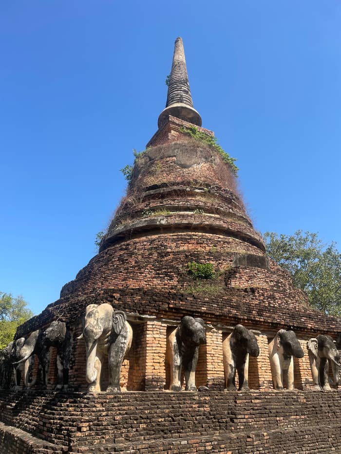
The ceramics town
The spiritual centre
See the cycling day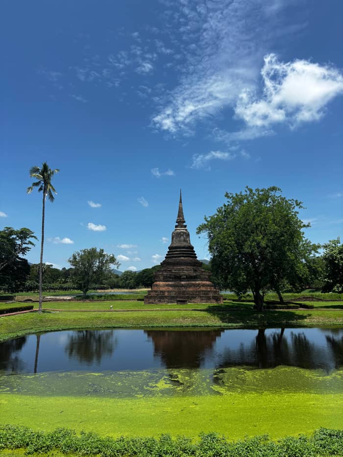
The fortress
The frontier town
See the cycling dayThe kingdom's artistic reputation rests on a few forms. The Fine Arts Department describes the reign of Phramaha Dhammarajalithai as a golden age of art and architecture, with the walking posture of the Buddha image and the lotus-bud form of the stupa as signature creations.14 The king himself also wrote a Buddhist treatise, the Tri Bhumikatha, to educate his citizens.55 Both the images and the book were tools of kingship.
Look at the temples with that in mind. UNESCO notes that many impressive monasteries were built of brick covered with carved stucco,56 and that the rapid assimilation of many influences forged the style now known as the Sukhothai style.57 At Wat Mahathat, TAT describes a grand pagoda ringed by smaller ones as if they were a lotus, while the main pagoda of Wat Chana Songkhram looks like a giant bell.35,41 Different shapes, one workshop tradition.
The Ramkhamhaeng Museum is the place to see the portable side of the same art. An older TAT page says its highlights are the Sukhothai-style Buddha images, and it also displays Chinese porcelain.27 The museum shows finds from excavations at Sukhothai and Si Satchanalai in the 1960s.58 A visit before the ruins gives a sense of scale and style, and a visit after helps you remember what you saw.
The story in order
Foundation
The 2nd stone inscription records the first monarch of the Sukhothai dynasty.12
Golden reign
He reigned over the golden age in the 13th century, with the alphabet credited to him.13,3
Art
The golden age of art and architecture produced the walking image and the lotus-bud stupa.14
Decline
The state broke into self-governing cities before being reunited.15
Absorption
Sukhothai became a part of the Ayuthaya state.4
Survey
The Fine Arts Department began registering sites in 1935.16
Revival
Beyond temples, the kingdom was a feat of engineering. UNESCO says the people of the historic towns were accomplished in hydraulic engineering, modifying the landscape so that water was dammed and reservoirs, ponds and canals were built.29 The ponds scattered through the ruins that now look like decoration began as infrastructure.
Trade was the second pillar. UNESCO says the kingdom's economy was based on agriculture but also depended heavily on exports of high-quality ceramics,25 and it describes a state whose political and administrative systems were remarkably egalitarian for the time, with codified laws.59 The inscription's line about free trade fits that picture.32
The Thai name for the era reflects it. UNESCO says Sukhothai is known in Thai history as a Golden Age and as The Happiness of Thai or The Dawn of Happiness.60 The Mini Light and Sound programme that TAT staged at Wat Sa Si draws on the same themes: Thin Chok cloth, porcelain, the beginnings of the Thai alphabet and the national Loi Krathong celebration.61
Video
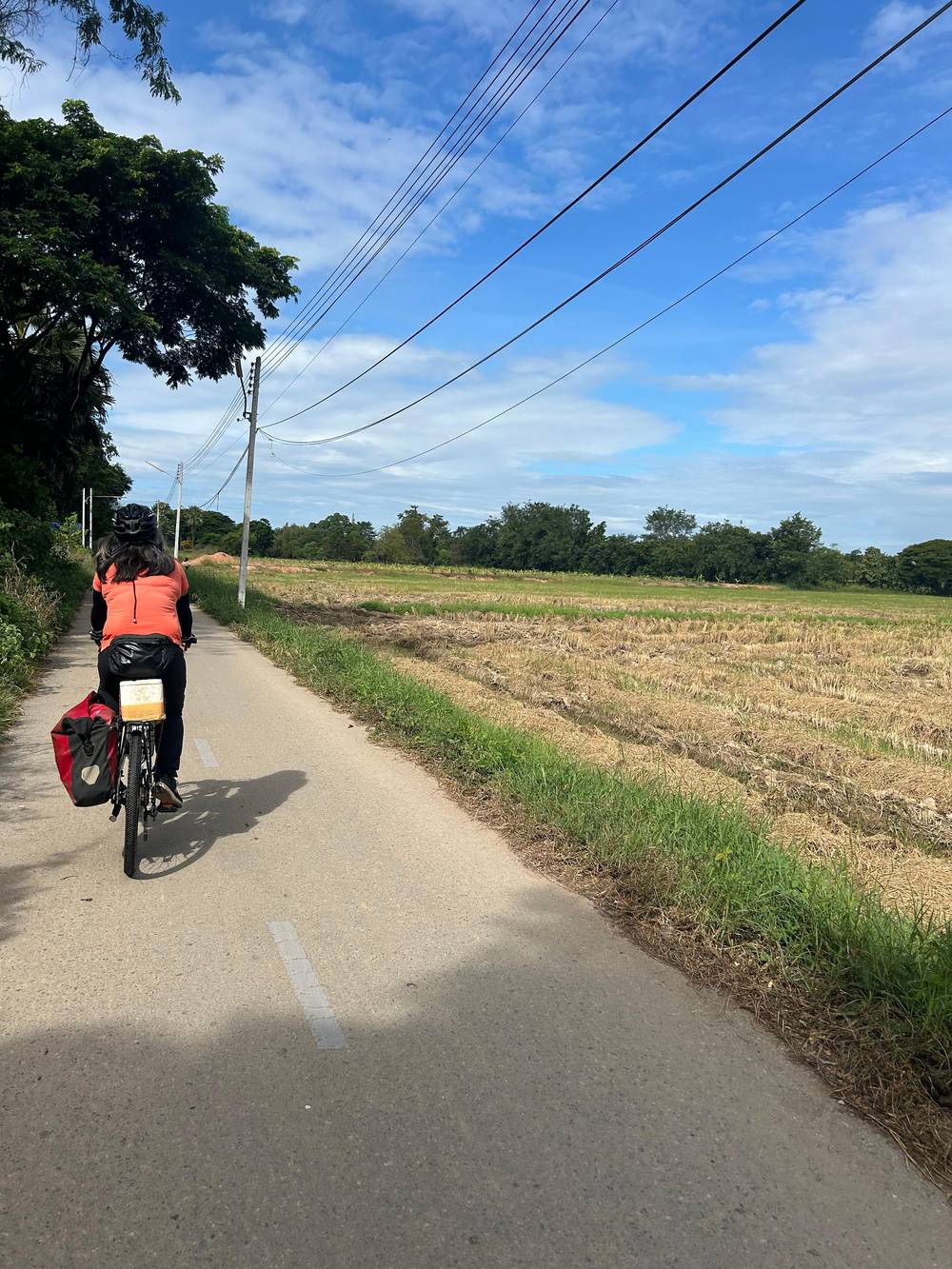
IWorldW on YouTube · The video stays unloaded until you press play.
they modified the landscape of the kingdom in such a way that water was dammed; reservoirs, ponds and canals were constructed
Reading the park
After King Ramkhamheng, the state broke up. The Fine Arts Department says it split into self-governing cities until Phramaha Dhummarajalithai, who was governing Si Satchanalai, led his army to bring them back together.15 The kingdom prospered again under him, though the pressure from outside never went away.
The pressure came from two directions. The department names the Lan Na Kingdom, centred on Chiang Mai, and Ayuthaya in the south as two rising powers that were more powerful than Sukhothai by the middle of the 19th Buddhist Era.49 Sukhothai sat between neighbours that were growing faster. For visitors, that tension is part of what the ruins show: a capital built for a confident kingdom that later had to share the region with larger rivals.
The outcome was gradual. The department says Sukhothai became a part of the Ayuthaya state in the Buddhist Era year 1981,4 and that Ayuthaya sent a son born to a Sukhothai-dynasty wife to Pitsanulok as viceroy to govern the northern state.48 The old capital became part of a larger state. On the temple side, TAT dates that temple's abandonment to the late Ayutthaya era.62
The modern story begins with registration. The Fine Arts Department says it began exploring and registering the ancient city in 1935 and announced the registration of 75 archaeological sites.16 Excavation began at Wat Mahathat, with a second phase of work from 1965 to 1969.63 In 1975 the department fixed an archaeological site of 70 square kilometres, and in 1976 it began a master plan to turn it into a historical park.64,65
Princess Maha Chakri Sirindhorn presided over the opening of the historical park on 20 November 1988,5 and the UNESCO World Heritage Committee listed it with Si Satchanalai and Kamphaeng Phet on 12 December 1991, as listing number 574.6 UNESCO names the property the Historic Town of Sukhothai and Associated Historic Towns and calls it a serial property of 3 closely related ancient towns.23 The department counts 217 archaeological sites explored and researched to date.66
The story has a sting in it. UNESCO records that King Rama I removed 2,128 Buddha statues from Sukhothai.67 It also records that the sites are protected by the 1961 Act on Ancient Monuments, enforced by the Fine Arts Department.28 In 2019, UNESCO named Sukhothai a Creative City of Crafts and Folk Art,68 a reminder that the story did not stop at the ruins. UNESCO speaks of buildings with a long history of almost 1000 years.69
FAQ
The first Kingdom of Siam had its capital there, according to UNESCO.2
The department credits him with inventing the alphabet and calls it a legacy of the nation.3
The Lan Na Kingdom and Ayuthaya were more powerful by the middle of the 19th Buddhist Era.49
Princess Maha Chakri Sirindhorn presided over the opening ceremony.5
The listing covers Sukhothai, Si Satchanalai and Kamphaeng Phet, as listing number 574.6
Sukhothai accounts for 7,000, Si Satchanalai for 4,514 and Kamphaeng Phet for 338.20
It stands near the park entrance and preserves finds from Sukhothai and Si Satchanalai.40
Sources
Read next
Planning Sukhothai? Ask a real person here.