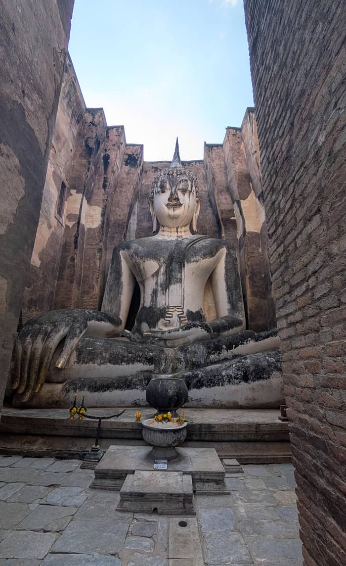
The picture stop
Wat Sa Si
The island sanctuary
See the cycling dayGuides
Language
Currency
Check datesfrom $49 · no cancel feeLocate your stop
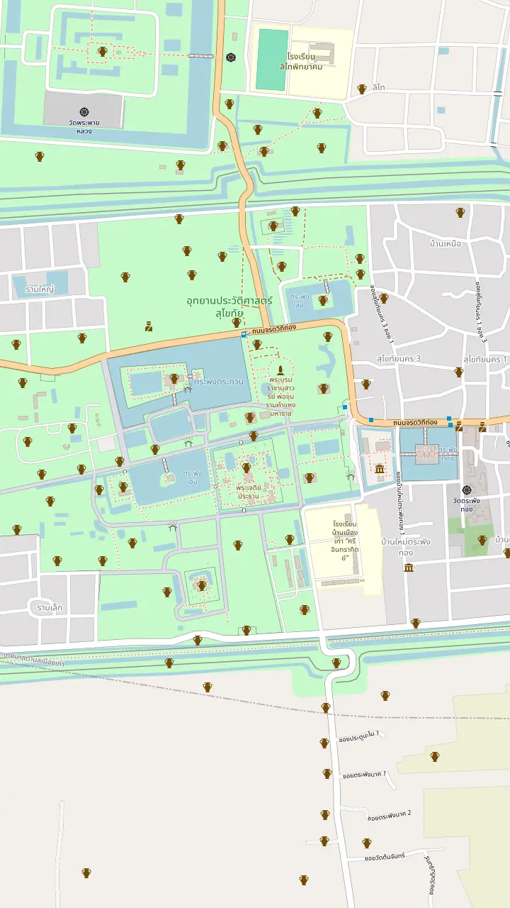
Map of 33 stops
Choose a route, then tap a pin or stop for its note and a Google Maps link.
TAT calls Wat Mahathat the centre of the historical park, with a grand pagoda ringed by 8 smaller ones as if they were a lotus.
Google MapsNorth of Wat Mahathat. TAT says its main pagoda looks like a giant bell.
Google MapsNorth-west of Wat Mahathat, with its main sanctuary on an island in Traphang Trakuan Pond.
Google MapsWest of Wat Mahathat, with no surrounding wall and a single lotus-style pagoda.
Google MapsSouth of Wat Mahathat, with 3 Lopburi-style prangs behind a laterite wall.
Google MapsA bronze statue of King Ramkhamhaeng on the north side of Wat Mahathat, at the end of Jarod Vitee Tong road.
Google MapsA small shrine north of Wat Mahathat: a single laterite prang where Lop Buri-style sandstone Hindu objects were found.
Google MapsThe Ramkhamhaeng Museum stands near the park entrance and keeps finds from Sukhothai and Si Satchanalai.
Google Maps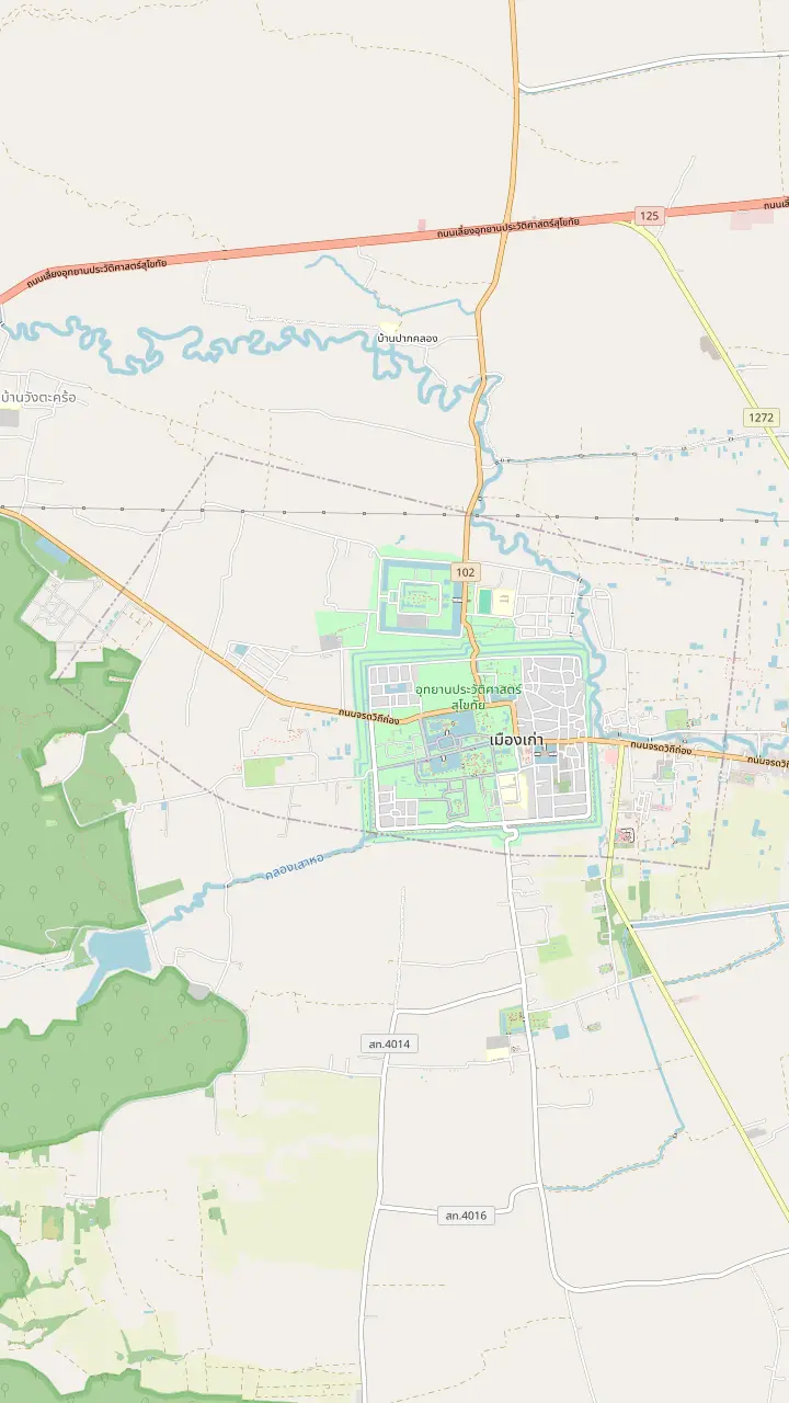
TAT calls Wat Mahathat the centre of the historical park, with a grand pagoda ringed by 8 smaller ones as if they were a lotus.
Google MapsHome of Phra Atchana, a gigantic seated Buddha image in the main hall.
Google MapsThe Fine Arts Department names its prasart among the Khmer-influenced works at ancient Sukhothai.
Google MapsThe temple stands in the Aranyik area, where King Ramkhamheng joined the Kathina ceremony at the end of Buddhist Lent.
Google MapsA temple in the eastern part of the park, on the road toward the town.
Google MapsSouth of Wat Mahathat, with 3 Lopburi-style prangs behind a laterite wall.
Google MapsThe Ramkhamhaeng Museum stands near the park entrance and keeps finds from Sukhothai and Si Satchanalai.
Google Maps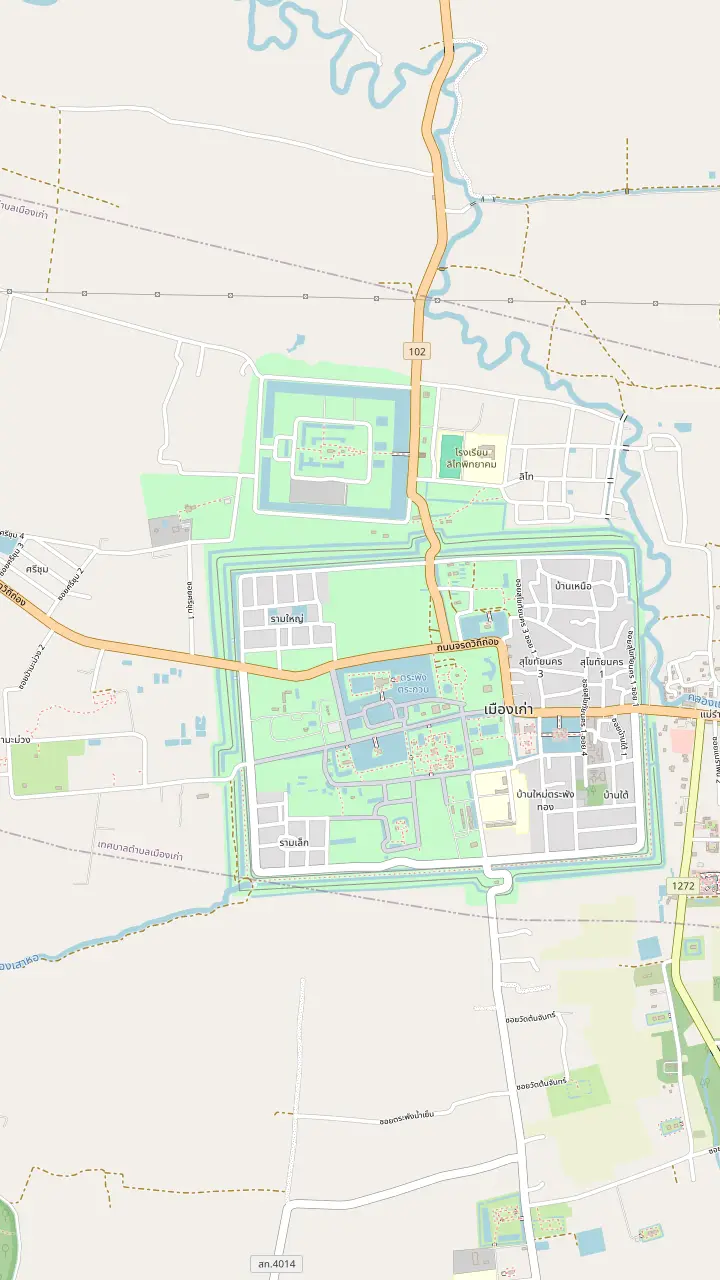
South of Wat Mahathat, with 3 Lopburi-style prangs behind a laterite wall.
Google MapsTAT calls Wat Mahathat the centre of the historical park, with a grand pagoda ringed by 8 smaller ones as if they were a lotus.
Google MapsHome of Phra Atchana, a gigantic seated Buddha image in the main hall.
Google MapsThe Fine Arts Department names its prasart among the Khmer-influenced works at ancient Sukhothai.
Google MapsThe Ramkhamhaeng Museum stands near the park entrance and keeps finds from Sukhothai and Si Satchanalai.
Google Maps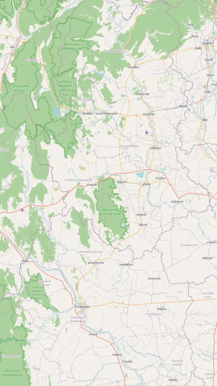
The park lies 12 km from the town of Sukhothai on the Sukhothai-Tak highway.
Google MapsUNESCO calls Si Satchanalai the spiritual centre of the kingdom and a centre of its ceramic exports.
Google MapsUNESCO describes Kamphaeng Phet as the kingdom's southern frontier town with military functions.
Google Maps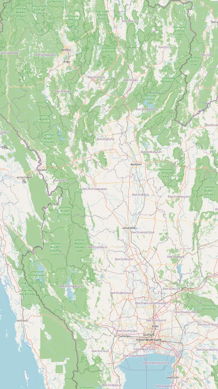
TAT puts Sukhothai 420 km north of Bangkok, four to five hours by car or 1 hour 15 minutes by air.
Google MapsThe kingdom in the south that Sukhothai ended up joining, according to the Fine Arts Department.
Google MapsAyuthaya made Pitsanulok the seat of a viceroy over the northern state.
Google MapsCentre of the Lan Na Kingdom, a rising power that put Sukhothai at risk.
Google MapsThe airport nearest to the park; UNESCO describes it as dedicated almost exclusively to bringing visitors to the historic towns.
Google MapsThe park lies 12 km from the town of Sukhothai on the Sukhothai-Tak highway.
Google Maps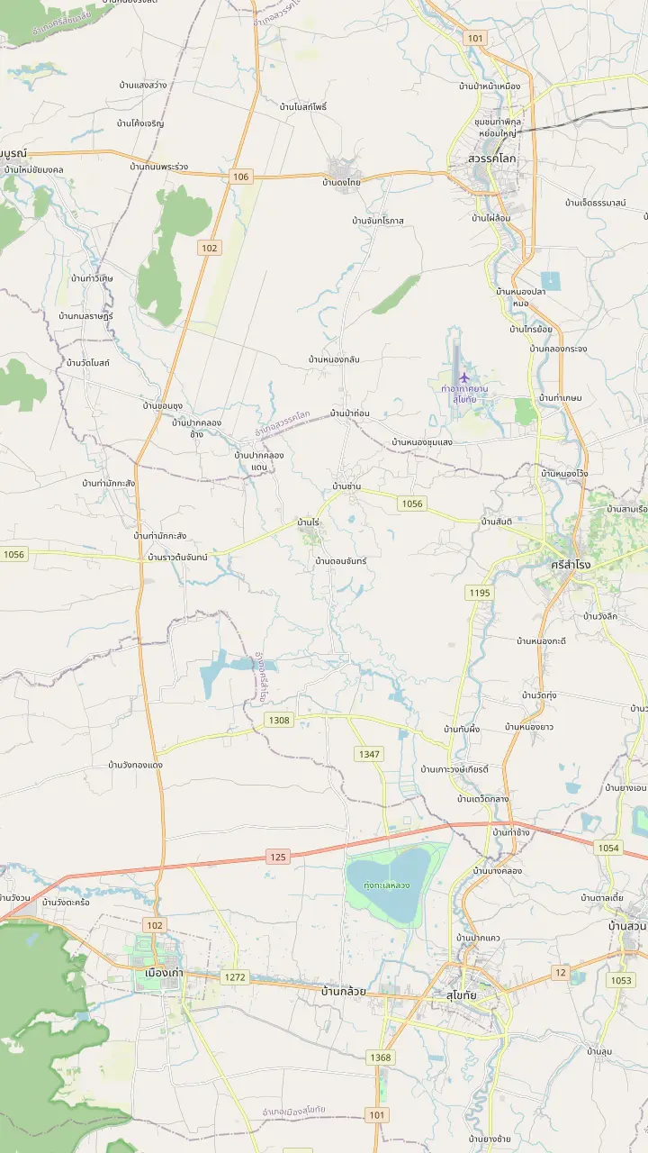
The modern town, with the shops and the bus terminal, where the Saturday walking street market sets up in the evening.
Google MapsThe park lies 12 km from the town of Sukhothai on the Sukhothai-Tak highway.
Google MapsThe airport nearest to the park; UNESCO describes it as dedicated almost exclusively to bringing visitors to the historic towns.
Google MapsA town north of the airport whose old Chinese quarter has street art made in a 2019 TAT project.
Google Maps© OpenStreetMap contributors · map data
The temple the whole park is organised around, the smaller ruins that ring it in every compass direction, and an order for walking or cycling them that keeps the light on your side.
Editorial team, sukhothaihistoricalpark.click · Updated November 12, 2026 · A 8 min read
Basics
If Sukhothai Historical Park had a single address, it would be Wat Mahathat, and Wat Mahathat in Sukhothai is where any visit should start. The Tourism Authority of Thailand calls the temple the centre of the historical park and describes a grand pagoda that stands surrounded by 8 smaller pagodas, as if the group were the petals of a lotus.1 That image is worth carrying into the ruins. The temple is a layout before it is a building, with a core, a ring and a courtyard of bases and columns that you read from the middle outward.
The archaeology agrees about the temple's rank. When the Thai government set up a restoration committee for ancient Sukhothai, it began excavating at Wat Mahathat before anywhere else, and the committee's second phase of work ran from 1965 to 1969.9 UNESCO, for its part, dates the age of the kingdom's seat to the 13th and 14th centuries and praises monuments that mark the beginnings of Thai architecture.10 Both statements point at the same piece of ground.
Visitors who search for Sukhothai Wat Mahathat are usually trying to decide how long the temple deserves. Plan on a slow stop, not a photo from the gate. TAT shows the Buddha image Phra Srisakayamunee at Mahathat Temple in its own coverage of the park, and the temple is where the monuments around it begin to make sense.11 The rest of this guide is arranged around that stop, so the order of the central zone starts here.
The compass
| Place | Direction | What stands there |
|---|---|---|
| Ramkhamhaeng monument | North | Bronze statue on a throne23 |
| Wat Chana Songkhram | North | A giant bell-like pagoda2 |
| Wat Sa Si | North-west | Chedi on an island in a pond5 |
| Wat Traphang Ngoen | West | Stucco standing Buddha in 4 niches24 |
| Prasart Phra Ruang hill | East | Former royal palace ground14 |
| Wat Si Sawai | South | 3 prangs in Lopburi style4 |
Directions are those TAT gives from Wat Mahathat; the pins above are placed from OpenStreetMap and Wikidata coordinates and agree with them.
A good way to hold the central zone in your head is to treat Wat Mahathat as the middle of a compass. TAT places the King Ramkhamhaeng monument on its north side, at the end of Jarod Vitee Tong road,12 and Wat Chana Songkram on the north side as well.2 Wat Traphang Ngoen lies on the west side,3 and the Prasart Phra Ruang hill, once a royal palace, lies to the east.14
The remaining neighbours fill in the diagonals, and the wats in Sukhothai's central zone are close enough to visit on foot. Wat Sa Si sits to the north-west of Wat Mahathat,13 and Wat Si Sawai, on the south, carries 3 pagodas in Lopburi style.4 San Ta Pha Daeng is a small shrine of a single laterite prang with a staircase at the front, and Lopburi-style sandstone Hindu figures were found there.15 Open the map above and you can follow each bearing in turn, tapping a pin to read its note.
The city itself was fenced. TAT describes the defensive wall of the old city as two layers, with the inner layer built on higher ground from laterite.16 Tickets are sold by zone,17 and this guide stays within the central one, where the ruins sit close together. That compactness is what makes a bicycle or a slow walk work well for the temples described here, and it lets you hold the whole layout in your head.
Wat Sa Si in Sukhothai Historical Park is where the park meets water. TAT notes that its main sanctuary stands on an island set in Traphang Trakuan Pond, built around a chedi in Singhalese style, with a large viharn that holds a stucco Buddha image and 9 chedis of different sizes to the south.5 Few ruins anywhere are framed so neatly by a pond.
TAT's other description of the park singles the temple out for the building on a pool and the pagoda in Ceylon style, which sets it apart from the temples around it.13 The pond is the key to visiting well. Walk the causeway slowly, face the chedi, and wait for the light to flatten on the water. That is a matter of timing rather than a rule, and the best-time page of this guide explains when the park's evenings run.
The temple has also been chosen for staging. In 2023, TAT announced a Sukhothai Mini Light and Sound show for Wat Sa Si, with performances on the first Saturday of each month between February and August.28 That is a good reminder that the ruins are not frozen: they host programmes, and you should check the current schedule with the local TAT office before a visit rather than assume any event is still running.
Pick your stop
Say what you came for, and the compass points to the temple.
If The centrepiece of the park
Wat Mahathat
TAT calls it the centre of the historical park.1
If A reflection on water
Wat Sa Si
Its sanctuary sits on an island in a pond.5
If A quiet, open corner
Wat Traphang Ngoen
It has no wall and a single lotus-style pagoda.3
If The story behind the ruins
The Ramkhamhaeng monument
The base shows the king's life in bas-relief.23
If Context before the ruins
The Ramkhamhaeng Museum
It stands near the entrance and keeps the finds.8
Three stops compared
The picture stop
The island sanctuary
See the cycling day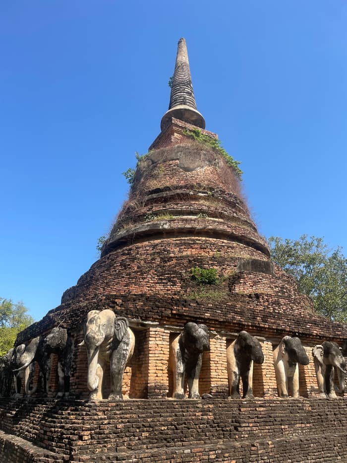
The quiet stop
Open to its pond
See the cycling day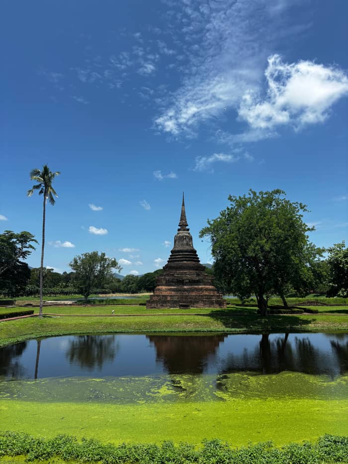
The shape stop
The bell-shaped pagoda
See the cycling dayWest of Wat Mahathat, Wat Traphang Ngoen keeps its square pedestal, its main sanctuary and a stucco standing Buddha image set in 4 niches, with a viharn in front and, east of the pond, an island holding an ubosot.24 TAT adds that the temple has no surrounding wall and holds only a single lotus-style pagoda.3 The calm of the spot comes from that openness, with the pond doing the framing.
North of Wat Mahathat, Wat Chana Songkhram is easier to recognise from a distance. TAT says its main pagoda looks like a giant bell,2 and the longer description gives the main sanctuary as a round chedi in Singhalese style,25 with the bases of 12 small chedis still visible around it.26 TAT also points to a strange chedi near the road that stands on 3 bases, one on top of the other.45
Treat the two as a pair of quick stops rather than destinations. Each rewards a few minutes of looking at its main image and its pond, and neither needs a plan. If a tour or a bicycle is carrying you through, the useful question is which side of Wat Mahathat you are on, and the compass at the top of this page answers it. The ruins will not hurry you, and the park's light does most of the work.
A morning route
Start
The Ramkhamhaeng Museum is near the entrance and holds the finds from the park.8
Early
Mid-morning
The centre of the park, with its grand pagoda and ring of smaller ones.1
Late morning
West of Wat Mahathat, open to the pond with no wall around it.3
Midday
North-west of Wat Mahathat, on its island in the pond.13
Afternoon
South of Wat Mahathat, with the Lopburi-style prangs.4
The bronze statue shows King Ramkhamhaeng seated on a throne, and TAT says its base carries a bas-relief of scenes from his life.23 It is the one stop in the central zone that is a modern memorial rather than a ruin, and it gives the temples around it their story. Ramkhamhaeng is the king the Thai script and Sukhothai's reputation are attached to.
The Fine Arts Department credits him with inventing the Thai alphabet, a legacy of the nation,46 and the script born at Sukhothai is still the one in use, according to UNESCO.47 One line of the stone inscription says no tax was collected and that anyone could trade freely.48 Those are the words behind the statue.
According to the department, his building programme covered many temples and Buddha images in Sukhothai.49 Standing at the monument, you can look south toward Wat Mahathat and see the temple the history refers to. The history page of this guide follows the kingdom from its rise to its absorption by Ayutthaya, so there is no need to learn the whole chronology on the spot. A short pause here is enough to tie the king to the ruins.
Video
nomadraul on YouTube · The video stays unloaded until you press play.
the rapid assimilation of all these elements forged what is known as the 'Sukhothai style'.
Before you go
Start with the museum if you want context. TAT says the Ramkhamhaeng Museum stands near the entrance of the park and preserves archaeological finds from Sukhothai and Si Satchanalai,8 and an older TAT page adds that its highlights include the Sukhothai-style Buddha images, with Chinese porcelain among the displays.50 A short visit inside makes the temples easier to read.
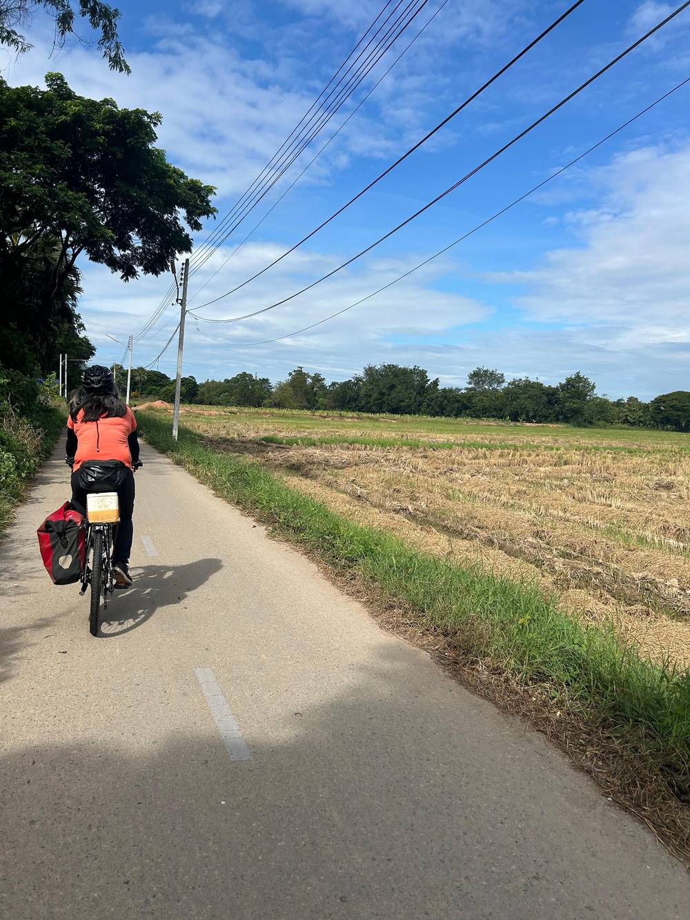
Next, check the clock. The Fine Arts Department puts the opening at 6:30 AM and the closing at 7:30 PM on weekdays and Sundays,6 with a late Saturday closing at 9:00 PM.7 TAT notes that trams and rental bicycles are available inside the park for covering its large area.42 Cycling is the usual way to link the temples, and the guided day we link to is a ride that enters at the Eastern Gate.
A sensible order follows the compass. Start at the monument and Wat Chana Songkhram on the north side, cross to Wat Mahathat for the centrepiece, drift west to Wat Traphang Ngoen, then loop north-west to Wat Sa Si, and finish at Wat Si Sawai to the south. Keep the hottest hours for the shade of the larger temples, and ride the open stretches early or late. The information centre in the park displays models of the old buildings, which helps with the layout.51
The central temples change character in the evening. In July 2022, an event lit up the ancient architecture at Wat Mahathat, Wat Chana Songkhram and Wat Sa Si,52 and TAT has since written about cycling through the park at sunset under the glow of lanterns.53 The same ruins that look pale at noon turn gold and then dark blue, and the pond at Wat Sa Si becomes a mirror.
Loy Krathong gives the temple its biggest night. TAT names the Loy Krathong programme held at Mahathat Temple as a night-time experience to seek out,54 and UNESCO adds that traditional festivals continue on the site.55 The festival page of this guide covers the dates and the etiquette of floating a krathong.
For an ordinary evening, the fact that matters is the Saturday extension to 9:00 PM, since every other day the gates close at 7:30 PM.7,6 That leaves a window for a slow last circuit of the central zone. Bring water, wear a light layer for the breeze across the ponds, and keep your shoes and shoulders in line with temple etiquette, since the temples remain places of worship.55
FAQ
TAT calls it the centre of the historical park, with the grand pagoda surrounded by 8 smaller ones.1
The main sanctuary is on an island in Traphang Trakuan Pond, built around a chedi in Singhalese style.5
TAT says the park offers tram services and bicycles for rent to explore its large area.42
Its collection comes from excavations at Sukhothai and Si Satchanalai, and it sits beside the park entrance.8
Sources
Read next
Planning Sukhothai? Ask a real person here.